Nandurbar district is an administrative district in the north-western part of the state of Maharashtra, India. It lies in the Khandesh region and forms the state's tribal-majority frontier with Gujarat to the west and Madhya Pradesh to the north. The district headquarters is the town of Nandurbar.
| Country | India |
|---|---|
| State | Maharashtra |
| Region | Khandesh |
| Division | Nashik |
| Headquarters | Nandurbar |
| Formed | 1 July 1998 |
| Parent district | Dhule |
| Tehsils | Nandurbar, Navapur, Shahada, Taloda, Akkalkuwa, Akrani (Dhadgaon) |
Formation
Nandurbar district was carved out of the erstwhile Dhule district on 1 July 1998, when the Government of Maharashtra bifurcated Dhule to create a separate district to better administer its tribal western talukas. At the time of formation, the new district comprised six tehsils.
Geography
The district covers the western edge of the Khandesh plateau and the southern slopes of the Satpura Range. The Tapti (Tapi) and the Narmada river systems both influence drainage in the district, with the Narmada forming part of the northern boundary near Akkalkuwa and Akrani. The terrain rises from the agricultural plains of Shahada and Nandurbar in the south to the forested hills of Toranmal in the north. Toranmal, a hill station in Akrani tehsil, is the most prominent elevated tract.
The district is bordered by Dhule district to the east and south-east, the state of Gujarat (chiefly the districts of Tapi, Narmada and the Dangs) to the west, and Madhya Pradesh (chiefly Barwani district) across the Narmada to the north.
Administration
Nandurbar district forms part of the Nashik division of Maharashtra. It is administered by a District Collector and a Zilla Parishad. The district is divided into six tehsils: Nandurbar, Navapur, Shahada, Taloda, Akkalkuwa and Akrani (also known as Dhadgaon).
Politics
The district lies within the Nandurbar Lok Sabha constituency, which is reserved for Scheduled Tribes. Vidhan Sabha constituencies in the district include Nandurbar, Navapur, Shahada, Akkalkuwa and Akrani, several of which are also reserved for Scheduled Tribes.
Demographics
According to the 2011 Census of India, Nandurbar is among the districts of Maharashtra with the highest proportion of Scheduled Tribe population. Major tribal communities in the district include the Bhil, Pawra, Vasave, Kokna and Gavit. Marathi is the official language; Bhili, Pawri and other tribal languages, along with Ahirani (the Khandeshi dialect) and Gujarati, are widely spoken.
Economy
The economy is predominantly agrarian. Irrigated tracts in Shahada and Nandurbar tehsils, watered by the Tapti basin and the Sarangkheda and Prakasha command areas, produce sugarcane, cotton, banana, papaya and chillies; Nandurbar is one of the leading chilli markets in Maharashtra. Jowar, bajra, maize and pulses are grown in the rain-fed uplands of Akkalkuwa and Akrani. Forest produce, including tendu leaves and bamboo, supplements rural incomes in the Satpura tracts.
Transport
Nandurbar town is a junction on the Western Railway's Surat–Bhusawal line and is served by National Highway 6 and other state highways linking Dhule, Surat and the Madhya Pradesh border. The district has road links to Toranmal, Shahada and the river crossings on the Narmada.
Culture and places of interest
- Toranmal – a hill station in Akrani tehsil with the Yashavant and Khadki lakes and the Gorakhnath temple.
- Prakasha – a temple town on the Tapti, often called "Dakshin Kashi", noted for its Kedareshwar and Sangameshwar temples.
- Sarangkheda – host of the annual Chetak Festival, a traditional horse fair held around Dattatreya Jayanti.
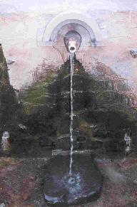
- Unapdev, Sunapdev and Nijhardev – hot springs in the Satpura foothills.
Related topics
References
- Government of Maharashtra, notification on the formation of Nandurbar district, 1998.
- Census of India, 2011 – District Census Handbook, Nandurbar.
- Wikidata entity Q1623525.